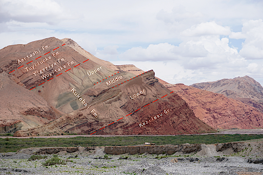
Kezilesu Gr
Type Locality and Naming
Western Tarim Basin. The Kezilesu Group was erected by the No.107 Geological Team under the Department of Geological Survey of the Xinjiang Petroleum Administration in 1976. The reference section is situated 3 km to the north of Kangsu, about 18 km west of Wuqia county (Wucha County) of Xinjiang. The group has not been subdivided into formations.
Synonym: (克孜勒苏群); The middle and lower parts of the group are called the Kapushaliang Gr in the Kuqa area, which is divided in ascending order into three formations, i.e. the Yagepumu Fm, Shushanhe Fm and Baxigai Fm.
Lithology and Thickness
The Kezilesu Group comprises dark red conglomerate, sandstone and sandy mudstone. Lower part is represented by dark red massive conglomerate, sandstone and brown red sandy mudstone with thin-bedded light green siltstone and fine sandstone. Upper part is light gray green and gray white massive medium and fine-grained quartz sandstone and brown red sandy mudstone with gray green siltstone and conglomerate bands. It is 1097-1300 m thick.
See item Kukebai Fm for its outcrop photographs.
Relationships and Distribution
Lower contact
Its base marked by dark red massive conglomerate is distinguished from tangerine sandstone of the underlying Kuzigongsu Fm (Middle Jurassic). It is in unconformable contact with underlying strata. In some regions, it overlies Paleozoic and/or the Proterozoic rocks.
Upper contact
Its top marked by gray white massive quartz sandstone is bounded by purple red mudstone of the overlying Kukebai Fm. It is conformable with the overlying strata.
Regional extent
The present group is distributed extensively. It is at the foot of the Tianshan Mountain, and in the Wulagen Uplift Zone and the Shalabel Mtns (Shaleibier Mountain) and discontinuously intermittent exposures being seen on the northern foothills of the Kunlun Mts. It is characterized by an inconsistent lithology, being capable of gradating laterally into conglomerate.It tends to decrease in thickness from west to east and is only 16 m thick in Buya-Pixi of Hetian. The middle and lower parts of the group are called the Kapushaliang Gr in the Kuqa area, which is divided in ascending order into three formations, i.e. the Yagepumu Fm, Shushanhe Fm and Baxigai Fm.
GeoJSON
Fossils
The group is well-developed stratigraphically and yields ostracods Lycopterocypris circulata, Rhinocypris cirrita; estherias Yanjiestheria sp., Orthestheria sp.; sporopollen Cicatricosisporites, Schizaeoisporites certus, Dicheiropolis etruscus. It bears foraminifera Saccommina globosa; sporopollen grains Cicatricosisporites spp., Crybelosporites spp., Clavatipollenites spp., Liliacidites spp.; on the Yigeziya section it bears Ostracods Darwinula contracta, Rhinocypris cirrita, Lycopterocypris circulata; on the Pusige section it bears Cypridea (C.) koskulensis. In the area of the Kangsu River there have been found fossil limb bones of Psittacosaurus.
Age
Depositional setting
It is of continental delta facies. In the Kangsu area the middle and upper parts of the group and in the Kuzigongle area the upper part of the group are of littoral deposition.
Additional Information
